
Learning and Simulating the Earth’s Water Cycle
Overview
Terrestrial hydrology models simulate water, energy, and ecosystem processes at the land surface. These models provide information to weather forecast models and to water resource managers for purposes including drought monitoring, river forecasting, food security, climate impact assessments, dam and reservoir operation, and many others. Modern hydrology models assimilate a variety of remote sensing data from a constellation of Earth-observing satellites about soil moisture, vegetation, snow cover, and evapotranspiration. Thus, these models provide a framework for integrating multi-faceted and multi-resolution datasets into coherent and useful information.
Project Details
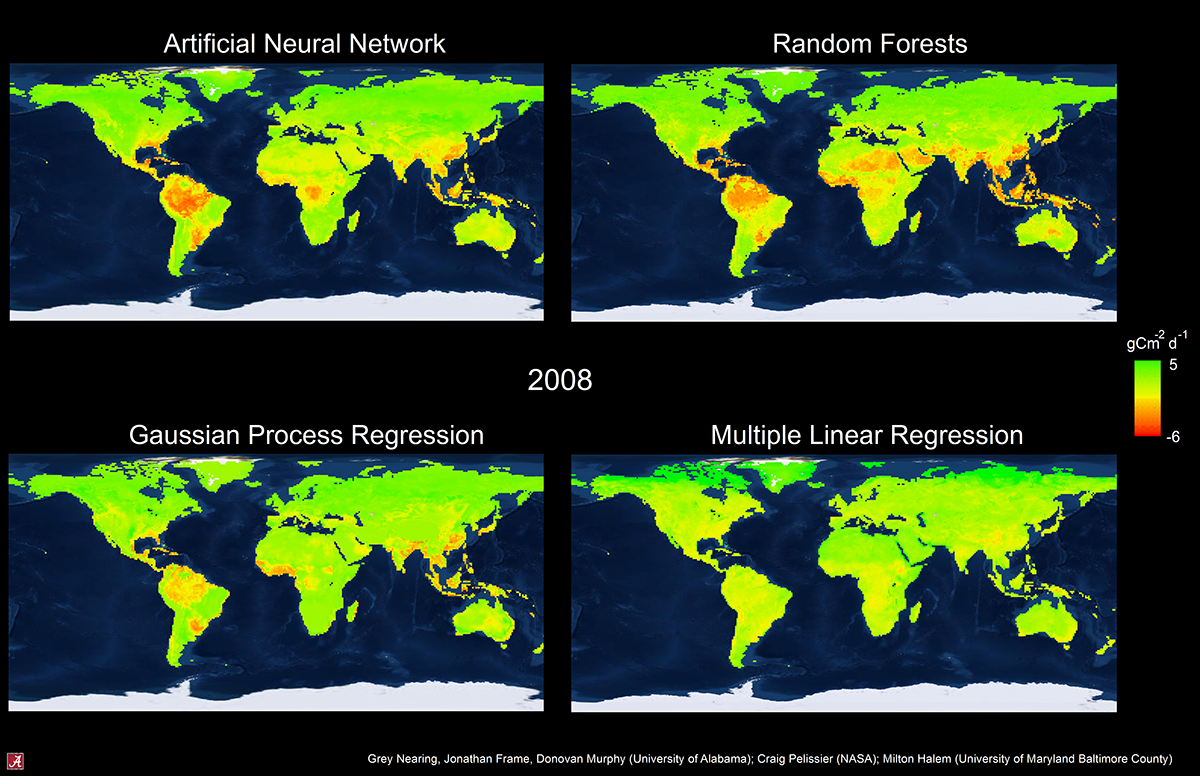
The goals of this project are to improve the ability of the NASA Land Information System (LIS) to learn about eco-hydrological processes and behaviors by assimilating a variety of data from ground networks and satellites. We are integrating machine learning techniques into the LIS data assimilation framework in a variety of ways to help reduce uncertainties in the simulation model and to account for uncertainties in the data.
We use machine learning to improve the LIS model’s representation of key ecosystem feedback processes by learning from differences between satellite observations and model predictions. Information theory and causal network analyses are used to explore relationships between modeled vs. observed system behaviors at a variety of timescales to learn about model accuracy and reliability.
Results and Impact
Modern learning algorithms and techniques improve on existing capabilities of extracting information from global remote sensing data about water, energy, and carbon cycles at the land surface. So far, this project has created new data fusion estimates of global terrestrial carbon uptake from natural ecosystems and is being used to improve model calibrations for flood forecasting across the continental U.S.
Why HPC Matters

Hydrology models must generally be run over large spatial domains, and assimilating satellite data requires running large ensembles. These models are already computationally expensive, and the expense increases when we add the training and optimization routines necessary to learn new patterns and connections in large remote-sensing data records. Last year, we used approximately 6.5 million core-hours on the Discover supercomputer at the NASA Center for Climate Simulation (NCCS) running simulation ensembles at only four watersheds (out of thousands in the U.S. alone). To reduce the cost of integrating machine learning into these simulation runs, we parallelized Gaussian Process Regression training routines that resulted in advantageous scaling up to thousands of processor cores.
More Information
- See the poster for this demonstration (PDF, 1.4MB). As shown in the NASA booth at SC18.
gsnearing@ua.edu Craig Pelissier, NASA Goddard Space Flight Center
craig.s.pelissier@nasa.gov