
Immersive Earth Science: Exploring Climate Data with Virtual Reality
Overview
Have you ever seen people get really excited about climate data? The Earth Science Technology Office (ESTO), within the Earth Science Division of NASA's Science Mission Directorate, and Navteca are exploring virtual reality (VR) technology for the next generation of Earth science technology information systems. One of their first joint experiments was visualizing climate data from the Goddard Earth Observing System Model, Version 5 (GEOS-5) in VR, and the resulting visualizations greatly excited the scientific community. Having demonstrated the utility of VR in viewing pre-visualized science data encapsulated in a movie representation of a time series, further investigation has led to the capability of permitting the observer to interact with the data, make selections, and view volumetric data in an innovative way using VR.
Project Details

The project team investigated using VR for scientific analysis by creating an interface to the ArcGIS cloud-based mapping platform that enables the user to request and view data in VR from the NASA DISCOVER-AQ (Deriving Information on Surface conditions from Column and Vertically Resolved Observations Relevant to Air Quality) project. The DISCOVER-AQ flight paths are rendered as 3D shapes, and the user can select individual data points along the spiral and display corresponding measurements retrieved from the Atmospheric Science Data Center (ASDC) at NASA's Langley Research Center. A virtual console is presented through the VR interface that allows the user to select layers of data from the server in 2D, 3D, and full 4pi steradian views.
The second phase of the project has been the visualization of complex volumetric data from the Global Precipitation Measurement (GPM) mission. Using the output of a tool created at the NASA Center for Climate Simulation (NCCS), the 3D objects are visualized in the VR environment, allowing the viewer to feel immersed in the dataset. The GPM data, when visualized in VR, transforms complex volumetric data into 3D objects through which the viewer can navigate. The 3D structures of cloud and storm systems are especially compelling when visualized in the VR environment.
Results and Impact
By demonstrating the utility of VR in interacting with DISCOVER-AQ flight campaign measurements and also with GPM data, the investigation team has started a conversation about the potential for VR as a science tool beyond simple visualization. The 3D perspectives of how clouds and storms form, evolve, and affect weather and climate are especially well suited to exploring in a 3D format dynamically displayed in VR.
Why HPC Matters
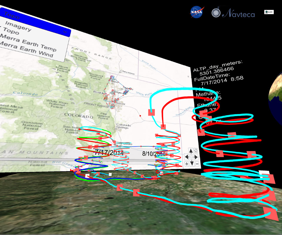
The VR visualizations utilize MERRA (Modern-Era Retrospective Analysis for Research and Applications) data from the GEOS-5 model. GEOS-5 product generation uses HEC resources at NASA Goddard Space Flight Center's NCCS. Thanks to NASA high-end computing, we have access to the high-resolution data output necessary for the VR visualizations.
What's Next
The early stages have produced promising results, and further investigation is warranted to determine if there is scientific merit gained from the VR format beyond that of traditional 2D displays. Current work includes additional manipulation of 3D and volumetric datasets and an ESTO-sponsored study of scientific applications for VR that will result in the identification of specific use cases. VR increases the potential to gain new insight into the roles that clouds, storm systems, and atmospheric aerosols play in regulating Earth's weather, climate, and air quality.
Shayna Skolnik, NASA Goddard Space Flight Center/Navtecasskolnik@navteca.com Ramon Ramirez-Linan, NASA Goddard Space Flight Center/Navteca
rlinan@navteca.com