High-Resolution Air Pollution Forecasting Using the NASA GEOS Model
Overview
Particulate matter, ozone, nitrogen dioxide, and other pollutants all have significant health impacts on humans and vegetation. Currently, surface air pollutant observations are sparse, leaving vast areas of the globe not well understood. NASA global models with state-of-the-science atmospheric chemistry equations help fill in the gaps left by these observations and provide insight on future conditions. Due to advances in computing and software engineering, the same computer models used for weather forecasting can be used as a foundation for better predicting air pollution.
Project Details
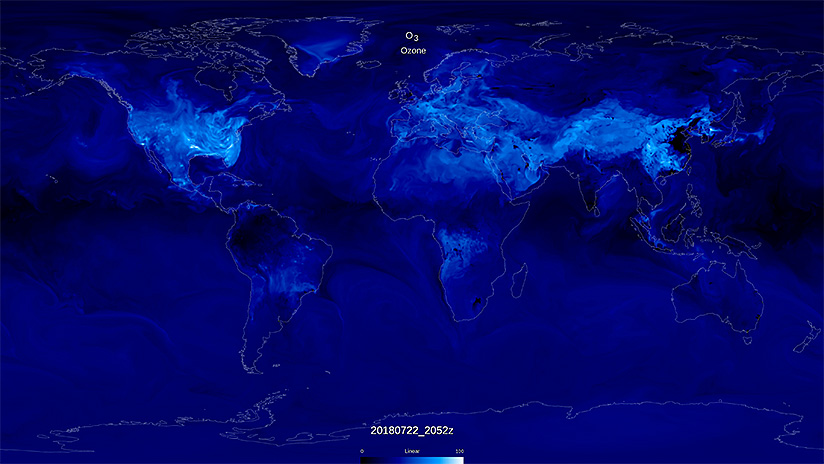
Forecasting air quality has typically been performed at the city, state, or country scale. To simulate the evolution of air pollutants at the global scale at high spatial resolution requires powerful supercomputing resources such as those provided by the NASA Center for Climate Simulation (NCCS). NASA Goddard Space Flight Center’s Global Modeling and Assimilation Office (GMAO) is using its Goddard Earth Observing System (GEOS) weather forecasting model to run global, high-resolution atmospheric composition simulations capable of providing air quality forecasts in near-real time. The GEOS Composition Forecast (GEOS-CF) model system’s resolution is 25 kilometers (16 miles) from Earth’s surface to the lower mesosphere, achieving 10 times higher resolution than conventional global simulations.
Results and Impact
Air quality can vary dramatically by both region and time of day. With a 5-day global air quality forecast, GEOS-CF provides high-quality information designed to support NASA flight campaigns, instrument teams, and satellite missions, as well as aid in decision making regarding human health and agriculture.
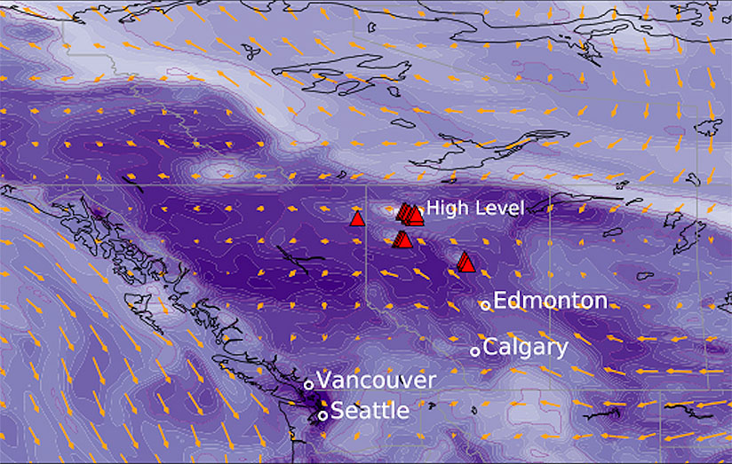
Recent and ongoing NASA field campaigns and instrument teams supported by GEOS-CF include the TRacking Aerosol Convection Interactions ExpeRiment–Air Quality (TRACER-AQ), the Arctic-Boreal Vulnerability Experiment (ABoVE), and the Asian Summer Monsoon Chemical and Climate Impact Project (ACCLIP). The GEOS-CF team provides custom visualizations for each field campaign, which has revolutionized campaign operators’ ability to target scientifically significant events with observations from aircraft, satellites, ships, and other platforms.
Why HPC Matters
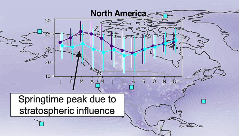
On the NCCS Discover supercomputer, GEOS-CF uses more than 3,500 compute processes across nodes containing 28 CPUs with 4.5 gigabytes of memory per CPU. The model takes advantage of PFIO (Parallel Fortran I/O server), which allows I/O offloading to dedicated nodes that are reserved for I/O operations rather than model execution. With I/O being performed asynchronously, each day GEOS-CF can produce 5-day forecasts within 9 hours.
The forecasting system produces approximately 1 terabyte of NetCDF data daily, which is then compressed to 450 gigabytes before being saved to online storage. Data visualizations are primarily provided via the NCCS-hosted FLUID system in the form of datagrams, surface maps, and total column plots. For our R&D efforts, we are integrating eViz, a Python Command Line Interface (CLI) visualization package that has a highly configurable interface.
What's Next
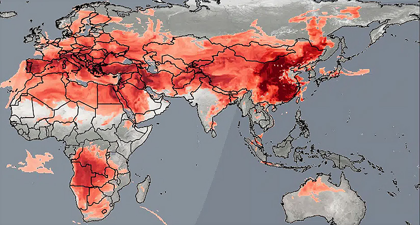
NASA’s GEOS-CF team is participating with the Environment and Climate Change Canada (ECCC) agency in a multi-model evaluation of air quality forecasts for North America. In terms of workflow, GEOS-CF is moving towards a Python-based workflow system that will perform experiment setup and manage simulation execution, handle data post-processing, and enable the creation of plots and movies for analysis. Through the workflow effort, we have identified small, interchangeable tasks to aid GEOS-CF researchers in accomplishing both reanalysis and forecasts more effectively. We are also using both the Google Earth Engine and Amazon Web Services (AWS) for disseminating two-dimensional hourly-averaged air quality fields for local government applications. We are planning to move to a higher vertical resolution in the future—from 72 to 91 model levels—and to add chemical constituent data assimilation.
More Information
- The Complex Chemistry of Surface Ozone Depicted in a New GEOS Simulation
- Simulation of Surface Ozone
- How NASA is Helping the World Breathe More Easily
- Using the Power of Global Air Quality Models and NCCS Supercomputing Resources, NYU and NASA Collaborators Create a Novel Index to Communicate Children’s Respiratory Health Risk
- GEOS-CF General Information Page
- FLUID Visualization System: GEOS-CF Composition Forecasts
Researchers
- Megan Damon, NASA Goddard Space Flight Center Please enable Javascript to see email address.
- Emma Knowland, NASA Goddard Space Flight Center Please enable Javascript to see email address.
- Christoph Keller, NASA Goddard Space Flight Center Please enable Javascript to see email address.
- Steven Pawson, NASA Goddard Space Flight Center Please enable Javascript to see email address.