
Advancing Research and Applications with NASA Climate Model Data
Overview
NASA's Climate Model Data Services (CDS) group provides tools and services to visualize, analyze, compare, and publish climate model data, specifically data produced at the NASA Center for Climate Simulation (NCCS). CDS aims to give diverse users intuitive interfaces to a complete collection of NASA model datasets. By broadening access to model data, NASA envisions advances in scientific research as well as new applications benefiting society.
Project Details
NASA climate model data includes model output from NASA's GEOS-5 and Model-E simulations as well as other land, atmosphere, ocean, and coupled climate products. These climate data products continue to grow in size as supercomputers become faster and are able to process models at higher resolutions. The resulting large datasets are not easily transferred to other science facilities.
Results and Impact
CDS is addressing this problem by providing a suite of services—covering classic, emerging, and advanced technologies—that can reduce the size of the data of interest, thereby reducing transfer times and local storage requirements. CDS provides the ability to:
- Visualize data to identify areas of interest.
- Create subsets by time and space to download only the area of interest.
- Download through various classic or emerging technologies.
CDS is further addressing the problems of searching, analyzing, and visualizing big data. We are doing that by developing services that can perform analyses and visualizations on CDS servers, allowing scientists to conduct science without having to invest in hardware or software capabilities. Planned services will provide the ability to use a common set of libraries to analyze climate data and write services that interface with CDS services via an application programming interface (API).
Role of High-End Computing Resources

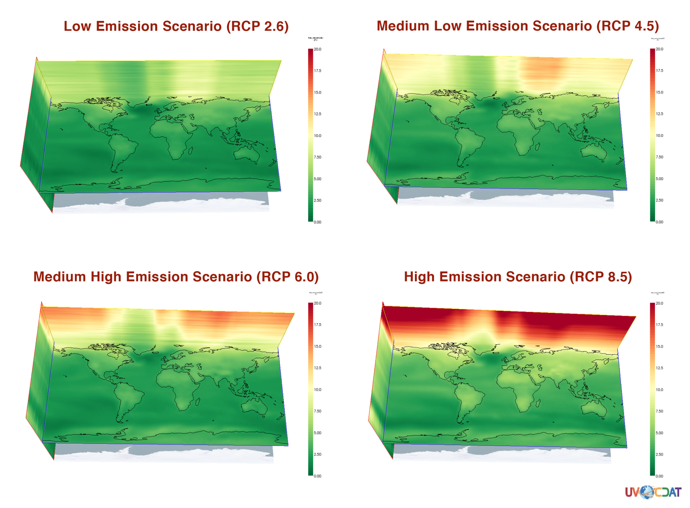
Using a subset of the above services, CDS helped create the Intergovernmental Panel on Climate Change (IPCC) Fifth Assessment Report multi-model means for visualization. CDS then republished the data through its Earth System Grid Federation data node for use by the climate science community. CDS services that are in development will benefit professionals in agriculture, urban planning, energy and water resource management, insurance, policy-making, disaster recovery, and national security planning.
Laura Carriere, NASA Goddard Space Flight Centerlaura.carriere@nasa.gov Mark McInerney, NASA Goddard Space Flight Center
mark.mcinerney@nasa.gov