
Zooming in with the NASA Earth Exchange
Overview
The NASA Earth Exchange (NEX) is a collaboration platform for the Earth science community that provides a mechanism for research, tools, and knowledge sharing to address global environmental challenges. NEX combines state-of-the-art supercomputing, Earth system modeling, workflow and knowledge management tools, and NASA remote sensing data feeds to deliver a complete work environment in which users can explore and analyze large datasets, run modeling codes, collaborate on new or existing projects, and quickly share results.
Project Details
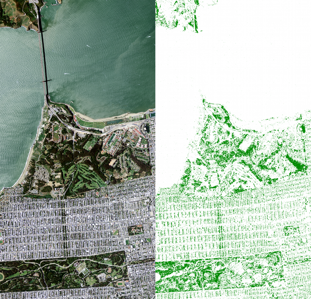
One of the key NEX objectives is to enable enhanced and more efficient use of Earth observations for NASA Earth Science technology, research, and applications programs. NEX utilizes the Pleiades supercomputer, together with over 1 petabyte of satellite, climate, and model datasets, to accelerate research in Earth sciences. Results and project details can then be shared with the community through the NEX portal—a web-based knowledge network.
Moreover, modeling, analysis, and computing processes for NEX projects can be archived, reproduced, transferred, and easily shared among scientists. This feature can potentially ease the tasks and reduce the costs of reproducing and verifying past results produced by other researchers. NEX capabilities also include a state-of-the-art collaboration platform that enables distributed teams to work together and share with the rest of the community through seminars and other outreach activities.
Results and Impact
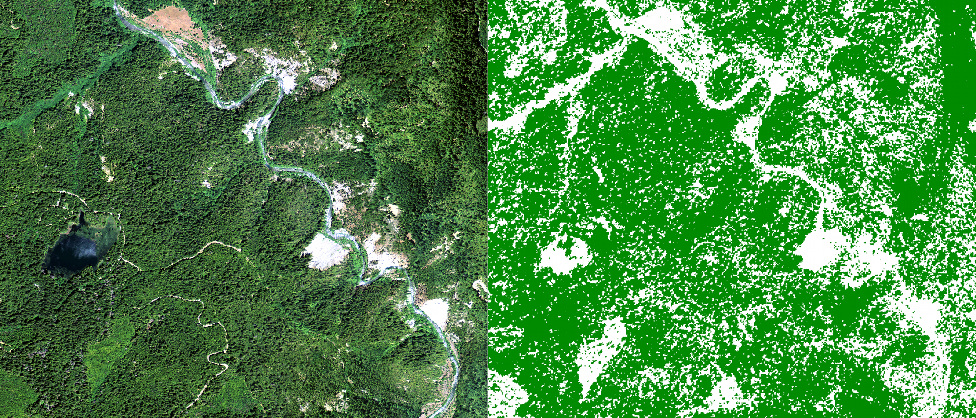
In one recent application of NEX, a team of researchers completed initial processing of the National Agriculture Imaging Program (NAIP) aerial 1-meter imagery in order to provide estimates of California forest cover. NEX team members Sangram Ganguly (Bay Area Environmental Research Institute), Andrew Michaelis and Petr Votava (University Corporation at Monterey Bay), and Rama Nemani (NASA) are currently working on extending this study to the entire U.S., and to other classes of variables beyond forests, such as roads, crops, or urban areas. At 1-meter spatial resolution, this provides a 30x - 250x “zoom” and the potential for significant classification precision improvement over existing 30-meter and 250-meter products.
As NEX development progresses, we strive to lower the barrier of entry to data- and compute-intensive science. NEX will provide a mechanism for continuous engagement among members of the global science communities to work together to address grand challenge problems in Earth sciences.
Role of High-End Computing Resources
The Pleiades supercomputer, combined with a massive data storage capacity and high-speed networks, enables NEX to engage diverse scientific communities and provide them with the capabilities to execute modeling and data analysis on a grand scale that was not previously achievable by most scientists. Processing over 12,000 images for the NAIP study—representing more than 5 terabytes of data—took only a few hours on Pleiades. Enhancing NASA's supercomputing environment with machine-learning and computer vision algorithms provided capabilities far beyond the current work being done in land cover classification.
Petr Votava, NASA Ames Research Centerpetr.votava@nasa.gov Andrew Michaelis, NASA Ames Research Center
andrew.r.michaelis@nasa.gov