
Modeling the Carbon Balance in Arctic Ecosystems
Overview
The Earth's northern latitudes contain vast amounts of organic carbon stored in permafrost and wetlands. A warming climate, amplified in the Arctic by the loss of highly reflective snow and ice, has the potential to release significant amounts of methane (CH4) and carbon dioxide (CO2). This massive perturbation would upset the current climate system. Our research focuses on developing an observation-modeling system to improve understanding of the current balance of carbon in the Arctic region and to provide a framework for early detection of future carbon destabilization. This research is being conducted in anticipation of NASA's forthcoming Arctic Boreal Vulnerability Experiment (ABoVE), which will provide new insight into the vulnerability and resilience of ecosystems and society to this changing environment.
Project Details
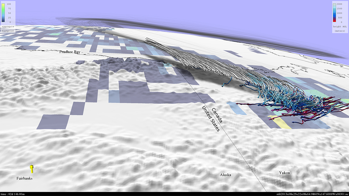
To more accurately describe the carbon balance in the atmosphere, it is necessary to associate atmospheric observations of CH4 and CO2 with the sources of these trace gases from the Earth's surface. This will also enable early detection of changes in the future, and help scientists attribute their sources. High-resolution modeling can help researchers make these associations by identifying regions of the Earth's surface from which fluxes, if any, would contribute to the observed downstream gas concentrations.
Atmospheric modeling using the Weather Research and Forecasting (WRF) Model generates nested high-resolution reanalyses of the meteorological flow patterns that occur during the observational time period. The nested WRF reanalyses use a 3.3-kilometer (km) grid covering Alaska, and 10- and 30-km grids over the remainder of the Arctic. The motion of air particles backward in time from each observation location—known as a "receptor"—is then determined using a particle dispersion model called Stochastic Time-Inverted Lagrangian Transport. The goal of this second component of the observation-modeling system is to compute a source-receptor relationship, called a "footprint," that describes the sensitivity of the observed gas concentrations to upstream surface fluxes.
Results and Impact
Footprint fields have been computed for more than 100,000 aircraft and tower-based receptors from NASA's Carbon in Arctic Reservoirs Vulnerability (CARVE) mission and from earlier campaigns. This effort required meteorological modeling to be performed over Alaska for multiple months during the years 1988 and 2012 – 2014, with comprehensive validation against meteorological observations ensuring the high quality of the footprint fields. Regional and monthly CH4 emissions estimates were then developed from these observational constraints.
Why HPC Matters
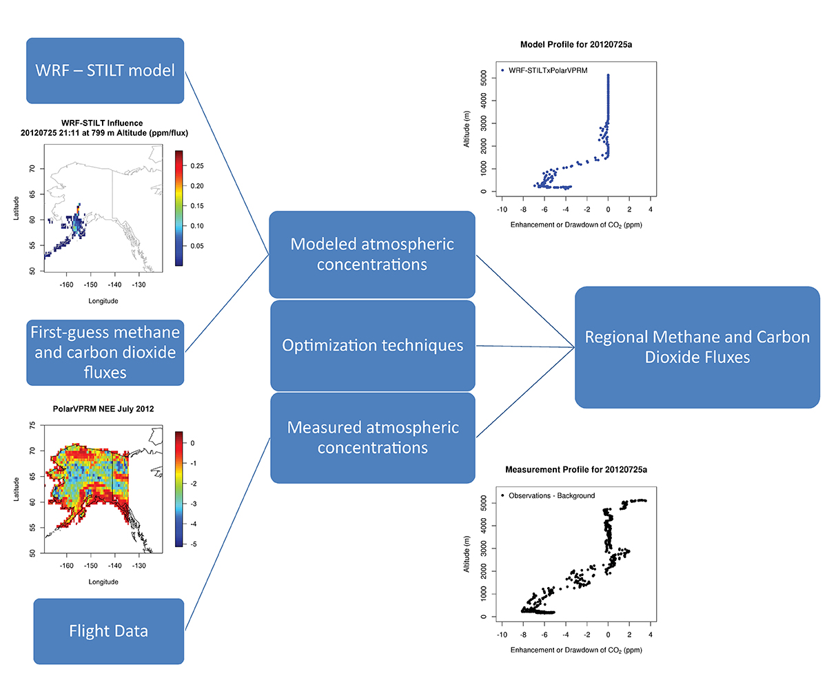
Modeling of the timeframes and spatial resolution required for this project is not possible without high-end computing resources. The Pleiades supercomputer at the NASA Advanced Supercomputing (NAS) facility enables time periods spanning multiple years to be modeled at a resolution that is higher than prior studies by an order of magnitude, which improves the representation of the region's complex orography and related flow fields. The Lou storage system at the NAS facility provides storage for the approximately 200 terabytes of data generated by the project to date.
The footprint fields are stored in a permanent database that can be used by future investigators. The database has been made available to the public at: https://ilma.jpl.nasa.gov.
What's Next
The modeling performed on Pleiades will continue to be refined with future model upgrades and ongoing efforts to incorporate current and historical observations. The proposed ABoVE campaign will benefit from the comprehensive observation-modeling framework being developed in this work.
John Henderson, Atmospheric and Environmental Researchjhenders@aer.com