Ultrascale Climate Data Visualization and Analysis
Overview
An explosion of data generated by the ever-increasing resolution in global models run on supercomputers and remote sensors on satellites and other platforms is inundating climate scientists. Maintaining rapid progress in Earth system research requires advanced tools for accessing, analyzing, and visualizing ultrascale climate data. To meet this need, the NASA Center for Climate Simulation (NCCS) at NASA Goddard Space Flight Center is developing an advanced computational infrastructure that will provide high-performance analysis and visualization capabilities to scientists' desktops.
Project Details
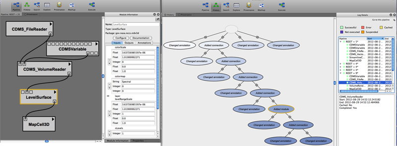
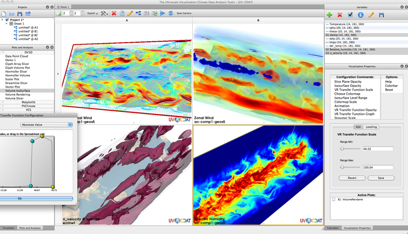
In collaboration with the Ultrascale Visualization Climate Data Analysis Tools (UV-CDAT) project, NCCS is developing climate data analysis and visualization tools for UV-CDAT, which provides data analysis capabilities for the Earth System Grid Federation (ESGF). These tools feature workflow interfaces, interactive 3D data exploration, hyperwall and stereo visualization, automated provenance generation, and parallel data processing.
NASA Goddard's DV3D is a UV-CDAT software package that enables exploratory analysis of diverse and rich datasets stored in the ESGF. DV3D provides user-friendly workflow interfaces for advanced visualization and analysis of climate data at a level appropriate for scientists.
Results and Impact
The UV-CDAT/ESGF computational services allow unprecedented access to high-performance data processing applications in support of Earth system science, facilitating climate data analysis operations that would otherwise be very difficult or impossible. This effort directly supports NASA's mission to use remote sensing data and global models to better understand the dynamics of the Earth system. Analysis of observational and model data is essential to understanding how changes to Earth system processes, such as climate, will impact humankind.
Role of High-End Computing Resources
DV3D's seamless integration with UV-CDAT's climate data management system and other analysis tools provides a wide range of climate data analysis operations; for example, simple arithmetic operations, regridding, conditioned comparisons, weighted averages, various statistical operations, and so on. Several teams are developing parallel versions of these tools that will enable users to analyze and display large datasets that currently cannot be processed with existing desktop tools. Scientists will be able to run analyses of supercomputer simulations that were previously intractable due to the large size of the datasets and, using DV3D, seamlessly couple these analyses with advanced visualization methods.
Thomas Maxwell, NASA Goddard Space Flight Centerthomas.maxwell@nasa.gov