Weather on Mars: The Meteorology of Gale Crater
Overview
On August 5th, 2012, the Mars Science Laboratory rover, Curiosity, landed in Gale Crater, near the Martian equator. The landing site was chosen for its high scientific value as well as its suitability to safe entry, descent, and landing (EDL) and long-term surface operations. To demonstrate safe conditions in the Martian atmosphere over Gale Crater, a lengthy investigation into the meteorology around the site was undertaken long before Curiosity made its historic landing.
Project Details
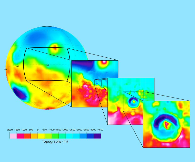
To understand the local meteorology at Gale Crater, we used the Mars Weather Research and Forecasting (MarsWRF) general circulation model (GCM) to simulate atmospheric behavior at various times of year over Gale Crater.
The flexible nature of MarsWRF allows us to use the same architecture to model the weather from global scales down to very fine-resolution grids that capture the local behavior within the crater itself, including winds, temperature and pressure. Local topography and surface properties are obtained from orbital observations from previous spacecraft.
Simulation results can be compared to data that will be obtained by Curiosity during its mission to evaluate the efficacy of such GCMs to serve a predictive role in understanding local meteorology. Additional investigations can also be run using a thicker, warmer atmosphere representative of early conditions on Mars to explore the possibility of liquid water existing in this location for long periods, much earlier in Mars's history.
Results and Impact
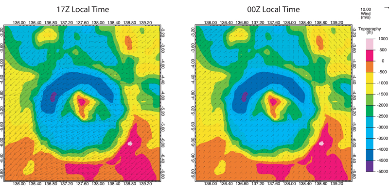
Results of the MarsWRF GCM simulations demonstrate a strong diurnal component to the wind field inside Gale Crater, with largely upslope winds (northerlies) during daytime and downslope winds (southerlies) at night. This is consistent with topographically driven circulation and similar to behavior seen along the flanks of topographic features on Earth.
The results of this work, especially the identification of areas in which the GCM does not match Curiosity's meteorological observations, will improve predictions for future missions on Mars and reduce overall system margins. This will have the effect of reducing mission cost, mass, and complexity.
Role of High-End Computing Resources
Use of the Cosmos supercomputer at NASA's Jet Propulsion Laboratory for the general circulation modeling, along with the availability of large, long-term storage of model output, were invaluable for achieving our objectives. A typical 30-day simulation, with four embedded model nests (from global to local scales) takes about three days on 16 processors.
Michael Mischna, Jet Propulsion Laboratory/California Institute of Technologymichael.a.mischna@jpl.nasa.gov Heidi Lorenz-Wirzba, Jet Propulsion Laboratory/California Institute of Technology
heidi.lorenz-wirzba@jpl.nasa.gov