Recent Advances in High-Resolution Global Atmospheric Modeling
Overview
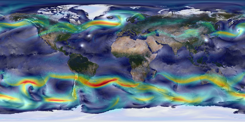
High-resolution global atmospheric modeling provides a unique tool to study the role of weather within Earth's climate system. The Goddard Earth Observing System Model, Version 5 (GEOS-5) is capable of simulating worldwide weather at resolutions of 10 to 3.5 kilometers (km). These mesoscale simulations produced with GEOS-5 represent multiple scales of atmospheric phenomena–from clusters of deep convection, to hurricanes, to large mid-latitude storm systems–within a unified simulation of the global circulation.
Project Details
The GEOS-5 global mesoscale simulations produce a realistic representation of our atmosphere at resolutions comparable to many satellite observations. This advancement provides an opportunity to perform comprehensive process studies on the formation of regional weather events and their impact on seasonal climate, improve the integration of existing observations into our data assimilation systems, and explore the potential of new observations through carrying out observing system simulation experiments.
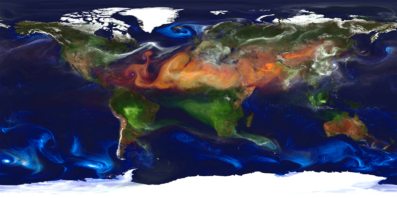
GEOS-5 uses the Goddard Chemistry Aerosol Radiation and Transport (GOCART) model within these simulations to include the global transport and direct radiative impacts of aerosols. These aerosols include dust particles lifted from the Earth's surface by strong winds and deep convection, sea salt blown from the ocean surface, plumes of sulfates from volcanic eruptions and fossil fuel emissions, and organic and black carbon within smoke from wildfires and human-initiated burning. These tiny particles can be transported long distances from their sources as they get caught up in the strong winds of the atmospheric circulation, and they can have a significant impact on air quality, visibility, and human health.
Results and Impact
A two-year global mesoscale simulation at 10-km resolution with GEOS-5 provides our first look at the potential of high-resolution simulations integrating global weather phenomena within the variability of seasonal climate change. The 10-km simulation captured the dynamic variability of North Atlantic tropical cyclone activity for the very active 2005 season and the more typical 2006 season. While resolution does improve the simulated variability of tropical cyclone formation, it is also a key element in improving the intensity of tropical cyclones that form within the model. At 10-km resolution, the GEOS-5 simulations begin to represent the strongest hurricanes with near-surface winds in excess of 160 miles per hour.
Role of High-End Computing Resources
The two-year, 10-km GEOS-5 global mesoscale simulation ran on 3,750 processors of the Discover supercomputer at the NASA Center for Climate Simulation for several weeks and produced over 400 terabytes of data. Experimental versions of GEOS-5 at 3.5-km resolution represent the future of global atmospheric modeling including non-hydrostatic dynamics, cloud microphysics, and interactive aerosols–known collectively within the community as global cloud-resolving models. This class of models requires more than 20 times the computational capability of the Discover supercomputer to complete a five-day forecast within the three-hour window required for the operational data assimilation system.
William Putman, NASA Goddard Space Flight Centerwilliam.m.putman@nasa.gov