
Using Katrina and Sandy Data to Improve Hurricane Prediction Tools
Overview

Recent extreme weather events in the United States have emphasized the need for reliable, state-of-the-art weather forecasting. At the same time, advances in supercomputing technologies have led to significant improvements in global climate modeling, and the accompanying simulations reveal remarkable details that enable us to revisit the fundamental role of the butterfly effect in short-term and extended-range weather prediction.
One of NASA's research goals is to develop new observational capabilities and analytical tools to learn more about the fundamental processes that drive hurricanes and to help utilize data to improve forecasts. Our research studies focus on tools to determine if and how the scales and/or details of data (for example, large-scale flows or small processes—the butterfly effect) may impact the dynamics of hurricanes and, consequently hurricane predictions, providing guidance on how to assimilate the data into the modeling systems.
Project Details
We developed MAP, a scalable multiscale analysis package that consists of the parallel ensemble empirical mode decomposition (PEEMD) code and a stability analysis tool (SAT), and integrated this package into NASA's Coupled Advanced multiscale Modeling and Visualization system (CAMVis) framework to improve extended-range tropical cyclone (TC) prediction and TC long-term climate projection through:
- Understanding the TC genesis processes, the accompanying downscaling and upscaling by large- and small-scale events, respectively, and their subsequent nonlinear interactions.
- Identifying and revealing the downscaling and upscaling processes that may form a nonlinear feedback loop to stabilize or destabilize solutions.
- Discovering the hidden predictive relationships among mesoscale TCs, large-scale tropical waves, and small-scale convective processes.
Results and Impact
Hurricanes Katrina (2005) and Sandy (2012) are the costliest hurricanes in U.S. history to date, causing more than $170 billon in damage and economic loss. Improving tools to provide better predictions of these high-impact weather systems may help improve predictions of future events, which in turn may save lives and reduce damage costs. Running CAMVis-MAP on NASA's Pleiades supercomputer, we attained the following results:
- Accurate 5-day track and intensity predictions and high-fidelity 3D visualizations for Hurricane Katrina, showing its multiscale interactions with the approaching upper-level trough that may have led to the storm's intensification prior to landfall.
- Realistic 7-day track and 6-day genesis simulations of Hurricane Sandy; multiscale analysis with MAP/PEEMD and high-resolution visualizations revealed the multiscale processes of Sandy's formation and movement.
- Nonlinear analysis with SAT suggests that properly decreasing grid spacing may reduce chaotic responses.
- Simulations produced with MAP (PEEMD and SAT) revealed insightful multiscale processes that contributed to TC predictability.
Why HPC Matters
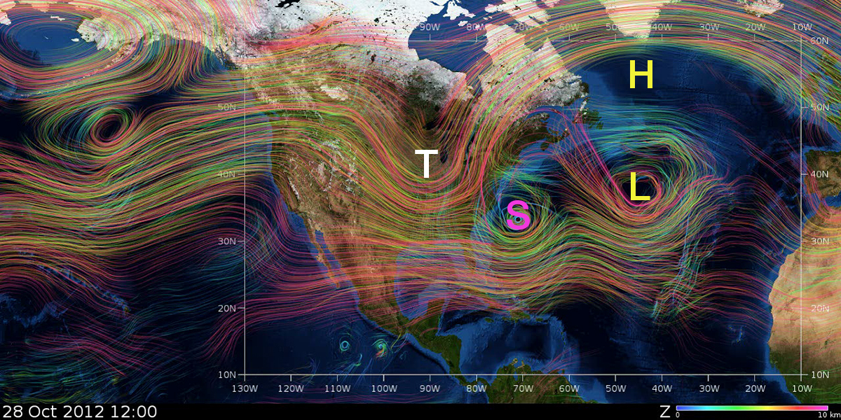
Recent increases in the power of Pleiades made it feasible for us to deploy CAMVis and MAP, which then enabled us to perform the research activities of Modeling, Observation, Analysis, Synthesis and Theorizing (MOAST), illustrating: 1) how research results from models and satellites are compared; 2) how multiscale analysis and synthesis can be used for proposing hypotheses of TC genesis; and 3) how the combined impact of 1) and 2) can help us revisit the role of the butterfly effect in the predictability of TCs. The MOAST cycle cannot be completed without seamlessly integrated supercomputer facilities that provide large-scale computing, visualization, and storage systems.
What's Next
We are now running multi-year tropical cyclone genesis simulations and analyzing results to understand how downscaling and upscaling processes may help predict TCs in numerical models.
More Media
See additional images/videos related to this demo in our media gallery.
bshen@mail.sdsu.edu