
Climate Data Downscaling Projects at NASA
Overview
It is common for NASA and other science organizations to use global climate models or Earth system models to perform climate projections decades into the future. Because of the long integration times and tremendous computing resources required for such projections, the model resolution is typically not at a spatial scale fine enough for climate assessment or decision support. The policy and management communities are hungry for climate projection information at finer resolutions for such purposes. Toward this end, researchers have developed a number of “downscaling technologies” over the years to bring the climate projection information to the local level.
With climate change consequences beginning to emerge, there is a continuous need for better quantifying of the quality of downscaled climate projections. NASA has ongoing efforts to produce high-resolution datasets and to understand the various downscaling techniques, including the limitations and risks involved in using them.
Project Details
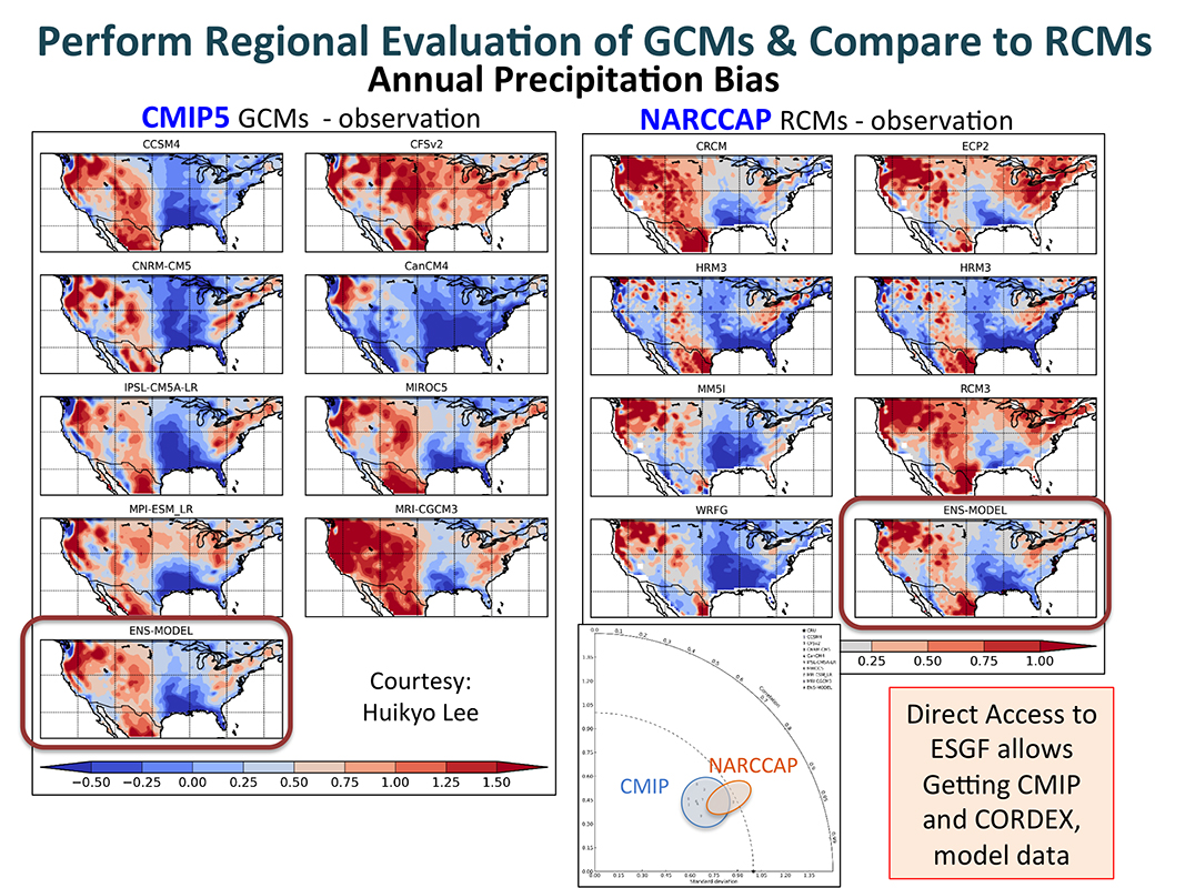
In the past couple of years, NASA has supported several regional and local climate projection activities:
- NASA Climate Adaptation Science Investigators focus on climate resilience at NASA Centers across the U.S.
- The National Climate Assessment (NCA) Capacity Building focuses on datasets and tools to support the NCA.
- The NCA Indicators System focuses on creating simple indicators specifically designed for decision support.
- Assessing the Fidelity of Dynamical Downscaling with the NASA Unified-Weather and Research Forecasting (NU-WRF) Model focuses on determining the credibility of a dynamical downscaling technique using a regional climate model.
All of these projects have a component in creating or using downscaled climate information. We will show some of the results produced in 2015 and also discuss a possible way forward.
Results and Impact
Multiple downscaled products have been generated using different techniques (e.g., statistical, dynamical downscaling, and data assimilation). These data products supported the most recent NCA and will be used in future assessments.
Why HPC Matters
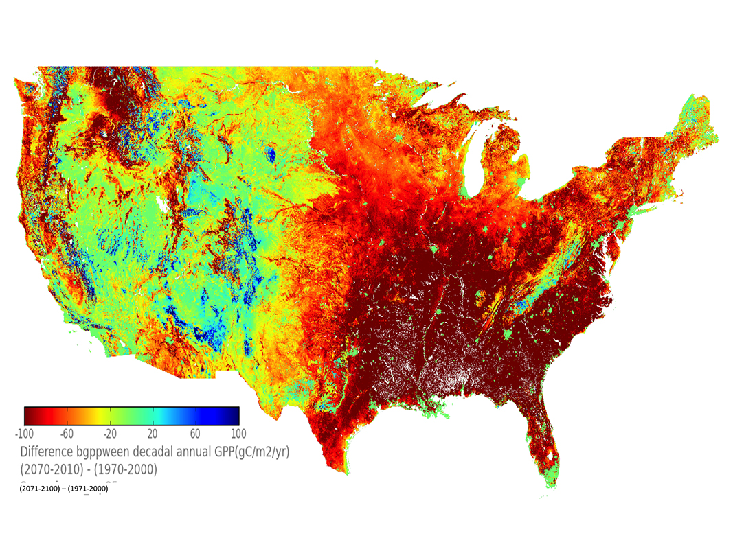
Long-term (typically at least 100-year) climate projections require long wall-clock model integration on a supercomputer. Because of significant computing resources needed for the simulation and associated post-processing, the models are typically configured to use lower-than-optimal spatial resolution. High-performance computing (HPC) systems are critical resources for supporting the model integration. HPC is also used for model output analysis, model and observational data assimilation, and high-resolution data product generation.
Tsengdar Lee, NASA Headquarterstsengdar.j.lee@nasa.gov