
Climate Modeling 101: From NASA Observational Data to Climate Projections
Overview
Computer models that simulate the climate are an integral part of providing climate information, including projections of future climate change. NASA, along with other national and international government agencies, universities, and industry participants, is developing and testing climate models.
A climate model is a system of models (or sub-models) that are integrated to simulate the Earth system. The sub-models include atmosphere, ocean, land surface, sea ice, chemistry, hydrology, and others. Each of these components represents different scientific disciplines and may have different computational algorithms with individual characteristic time and length scales.
Project Details

NASA invests significant resources to launch Earth observing satellites for gathering data. There are currently over two dozen satellite missions, and NASA makes mission data freely available to users around the world. Modelers use this data to understand physical phenomena and develop mathematical models of individual components, and to test the accuracy of the component models and the integrated climate model.
A climate model can generally be described as a set of time-marching, nonlinear, partial differential equations. These equations are then cast into difference equations that can be solved numerically on a computer. The difference equations are solved at the nodes on a numerical mesh. There are three meshes: one for the atmosphere, one for the ocean, and one for the land surface. At the boundaries between the meshes, boundary conditions must be passed between the various sub-models.
Climate model runs are very large, requiring supercomputers and advanced computational techniques in order to solve them. A prevalent technique is using the Message Passing Interface (MPI) to leverage thousands of cores.
Results and Impact
NASA maintains two global climate models, the Goddard Earth Observing System (GEOS-5) model from the Global Modeling and Assimilation Office (GMAO) and ModelE, from the Goddard Institute for Space Studies (GISS).
The GEOS-5 Data Assimilation System ingests 5 million observations every 6 hours to drive weather forecasts for managing NASA's fleet of science satellites and researching the impact of new satellite observations. GMAO scientists have also used GEOS-5 for multi-year, high-resolution "Nature Runs" to explore global weather patterns in a climate context as well as multi-decade reanalyses to probe past weather events with greater accuracy.
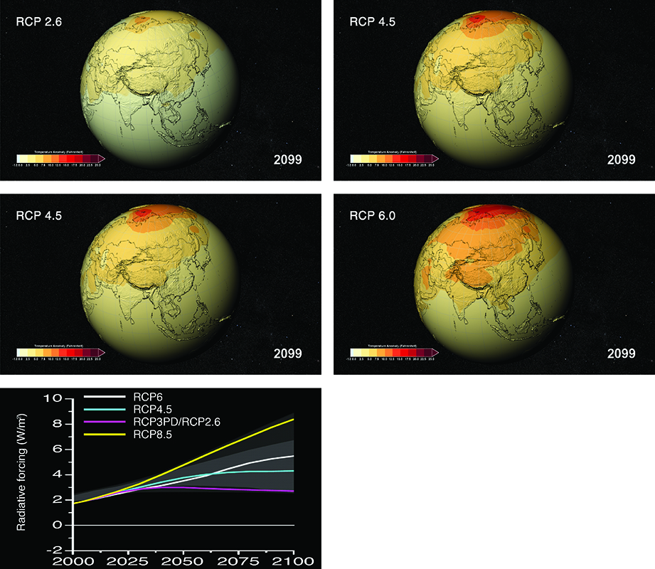
GISS participates in multinational experiments conducted by the Intergovernmental Panel on Climate Change (IPCC). Every five to seven years, modelers at several dozen institutions around the world run a set of numerical experiments, each using their own climate model. The most recent experiment, the Coupled Model Intercomparison Project Phase 5 (completed in 2013 for IPCC Assessment Report 5), created over 50 petabytes of data for the international community.
Why HPC Matters
Climate models require supercomputers to run, with GEOS-5 and ModelE leveraging the 80,000-core Discover supercomputer at the NASA Center for Climate Simulation. A typical climate science project requires multi-component ensembles, each using thousands of cores running for weeks at a time, resulting in millions of core-hours. Such a project can create hundreds of terabytes of data.
Phil Webster, NASA Goddard Space Centerphil.webster@nasa.gov