
Accelerating Science with AI and Machine Learning
Overview
Data holdings at NASA are growing at a geometric rate, with an estimated 100 petabytes of Earth science imagery alone. Traditional methods of analyzing these data are insufficient to produce answers in a reasonable time frame. Scientists have turned to Artificial Intelligence and machine learning (AI/ML) methods to facilitate the analysis of the large volumes of data. Here we present several projects that use various AI/ML methods in concert with high-performance computing (HPC) to derive products and inferences from image products including satellite imagery and model outputs. In addition, we will outline our plan to develop a unified approach to data science that incorporates AI/ML.
Project Details
The data science and analytics group in the Computational and Information Sciences and Technology Office (CISTO) is working with scientists and industry to take advantage of all available resources to accelerate science. This group has previously built data analytic services for climate reanalysis data, including the MERRA Analytic Service, Earth Data Analytics Service, and CREATE-V.
Currently, we are working with scientists to support landslide detection with commercial, high-resolution data, automatic detection of lake depth from Landsat data, routine mapping of surface water extent to support reservoir management, and using maximum entropy modeling to predict habitat suitability for species of particular interest. Our goal is to generate a software code base that uses ML techniques and is optimized for HPC systems and is reusable for many different projects.
Results and Impact
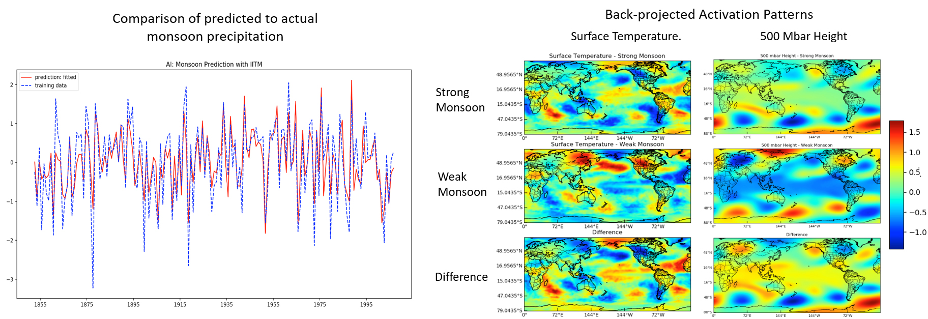
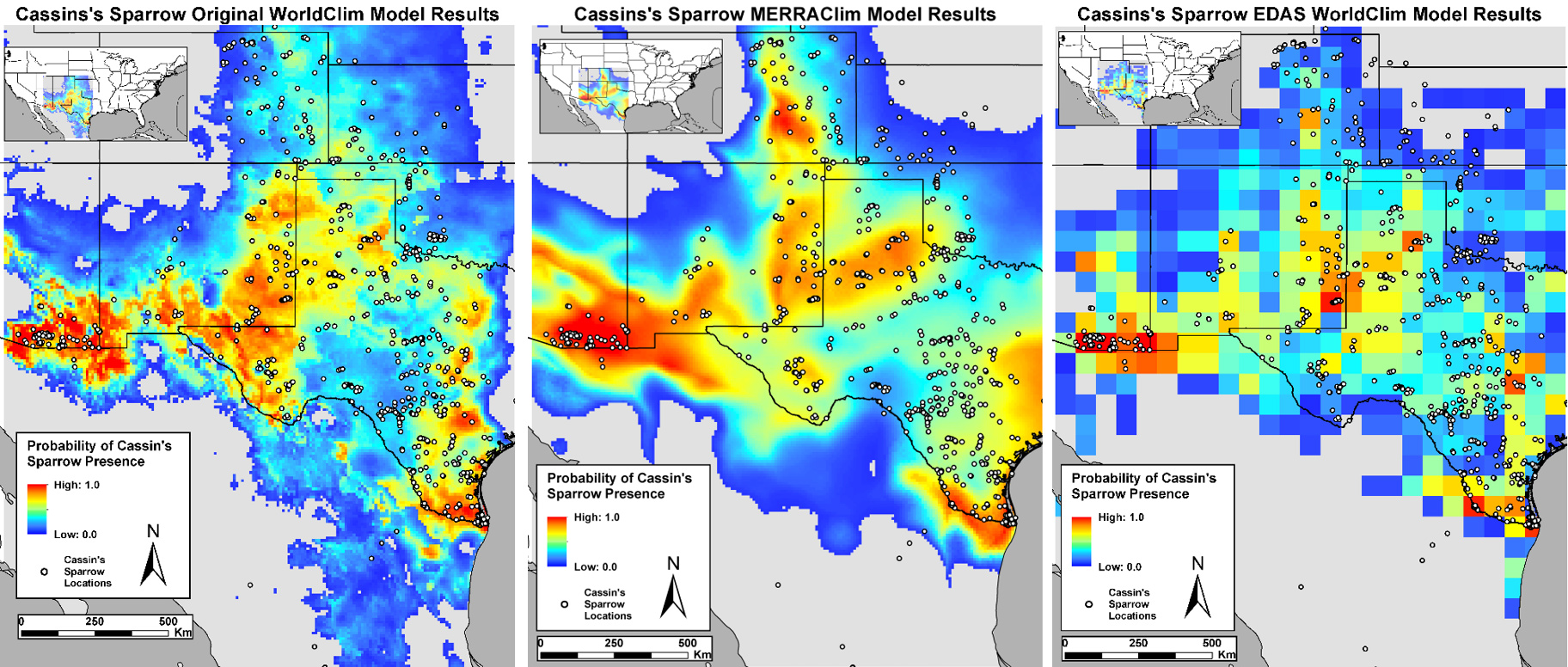
Physics-based models for weather and climate prediction are the standard because these models are trained to incorporate Earth system information and model the natural world as closely as possible. As the length of the observational record increases, it becomes possible to use ML to predict conditions based on past real-world events. The figures show a prediction of monsoon strength using Artificial Neural Network and climate data. This ML model identifies teleconnections between the climate variables surface temperature and atmospheric pressure with the strength of the ensuing monsoon season. The figures also show early results of habitat suitability mapping, which demonstrate that using MERRA inputs can yield comparable results to the standard WorldClim data inputs. WorldClim provides 19 climate-related variables (temperature, precipitation, etc.) that can be used as discriminatory variables in a diverse study. MERRA is a climate reanalysis dataset that provides hundreds of climate variables produced by the GEOS-5 climate model. The next step is to include the full suite of MERRA variables in the model in a Monte Carlo simulation to identify any key variables not in the WorldClim data that may contribute to improvements in the habitat suitability map.
Why HPC Matters
Development occurs in the Advanced Data Analytics PlaTform (ADAPT) computing environment at the NASA Center for Climate Simulation, but the design process includes consideration for running in the commercial cloud. All code is developed with standard computer science principles in mind to maximize the portability of the code to different processing environments and is parallelized to optimize performance.
More Information
- Accelerating Water Map-Making for the AB0VE Campaign
- Accelerated Data Processing Saves Time, Allows for More Thorough Research
- Advanced Data Analytics Platform (ADAPT)
- MERRA/AS and Climate Analytics-as-a-Service
- Earth Data Analytics Service
- CREATE-V
- MERRA-2
- See the poster for this demonstration (PDF, 2.8MB). As shown in the NASA booth at SC19.
- Download the demonstration slide deck (PPSX, 49.9MB) as presented in the NASA booth at SC19. Click "Read Only" after launching presentation.
mark.carroll@nasa.gov